Drones for Energy
Drone Inspections of Energy Infrastructure
Safe diagnostics of power lines, wind turbines and substations without disconnecting voltage. Thermal imaging and 48 MP photos from the air.
48 MP
Photo resolution
112×
Optical zoom
< 24h
Report delivery
0
Power outages
What does a drone energy inspection cover?
Overhead line inspection
Detailed photos of conductors, insulators and power poles. We detect corrosion, mechanical damage and excessive sag without approaching live lines.
Substation control
Thermal imaging of transformers and switchgear under load. We identify overheating connections, overloaded phases and potential failures before they occur.
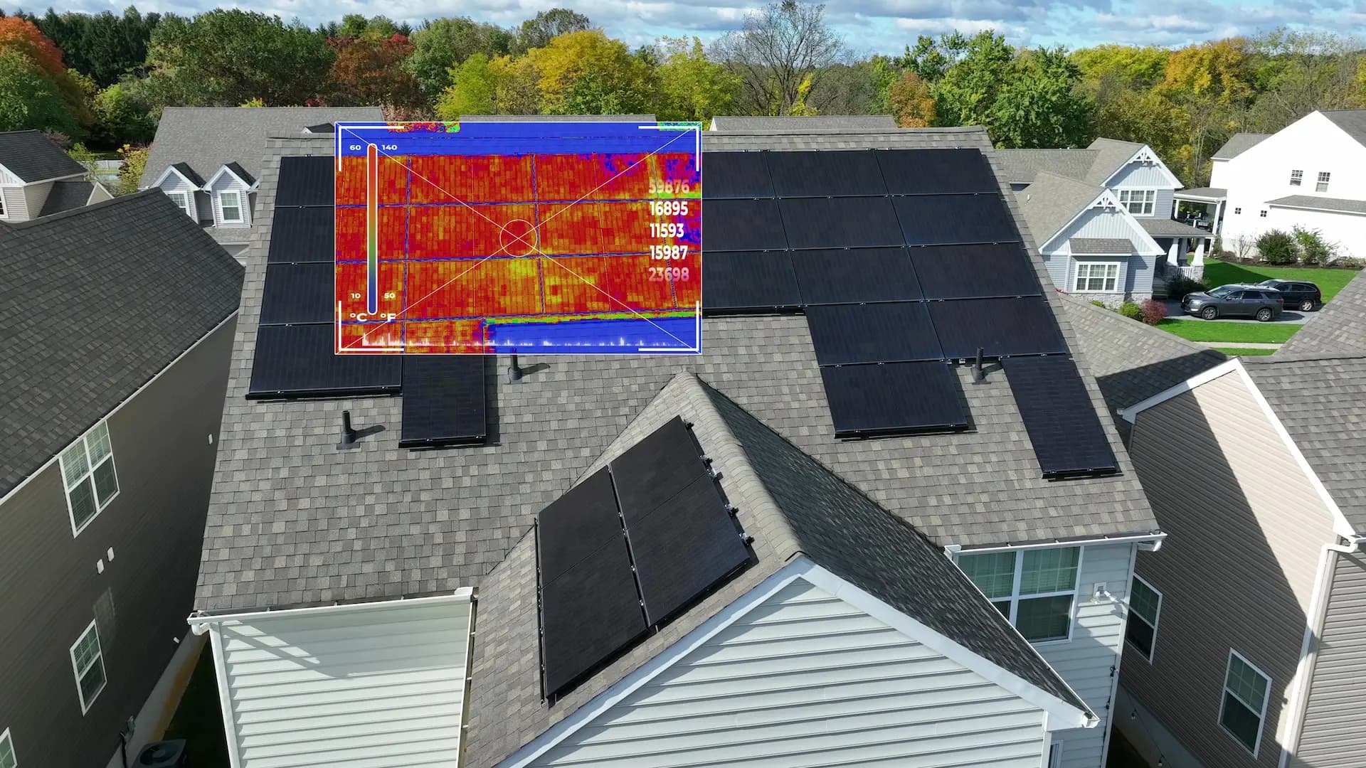
Electrical installation thermography
Thermal examination of busbars, fuses and cable joints. Overheated elements stand out on thermal images, indicating overload or loose connections.
Wind turbine inspection
Inspection of blades, nacelle and tower. We detect cracks, composite delamination and lightning strikes — without expensive scaffolding or rope access.
Energy storage diagnostics
Thermal imaging of battery containers and BESS systems. Early detection of overheating modules prevents thermal runaway and fires.
Technical report and recommendations
Complete PDF report with RGB and thermal images, GPS location of each anomaly, fault classification and repair priorities.
Who benefits from drone inspections in energy?
Drones revolutionize energy infrastructure diagnostics. Instead of shutting down live lines and sending climbers up 40-metre poles, our drone safely approaches every element with thermal and optical cameras. Result: faster inspection, lower costs, zero risk for people.
Get Free QuoteHow does a drone energy inspection work?
Site analysis
We define the inspection scope, check airspace zones and plan the flight route. For power lines, we set optimal altitude and distance from conductors.
Inspection flight
The drone with thermal and optical cameras (112× zoom) follows the planned route along the infrastructure. Every photo is geotagged with RTK accuracy ±2 cm.
Data analysis
We process thermal and optical images, classify anomalies by priority and identify elements requiring immediate intervention.
Report and recommendations
We deliver a PDF report with anomaly map, comparative photos, GPS coordinates and repair recommendations with urgency prioritization.
Drone applications in energy
Frequently asked questions — energy
Does a drone inspection require shutting down the power line?
What faults does thermal imaging detect at substations?
How far from conductors does the drone fly?
How long does a wind farm inspection take?
Can the drone fly near electromagnetic fields?
How much does a drone inspection of energy infrastructure cost?
What documents do I receive after the inspection?
Ready to get started?
Contact us and we'll send you a quote within 24h.